
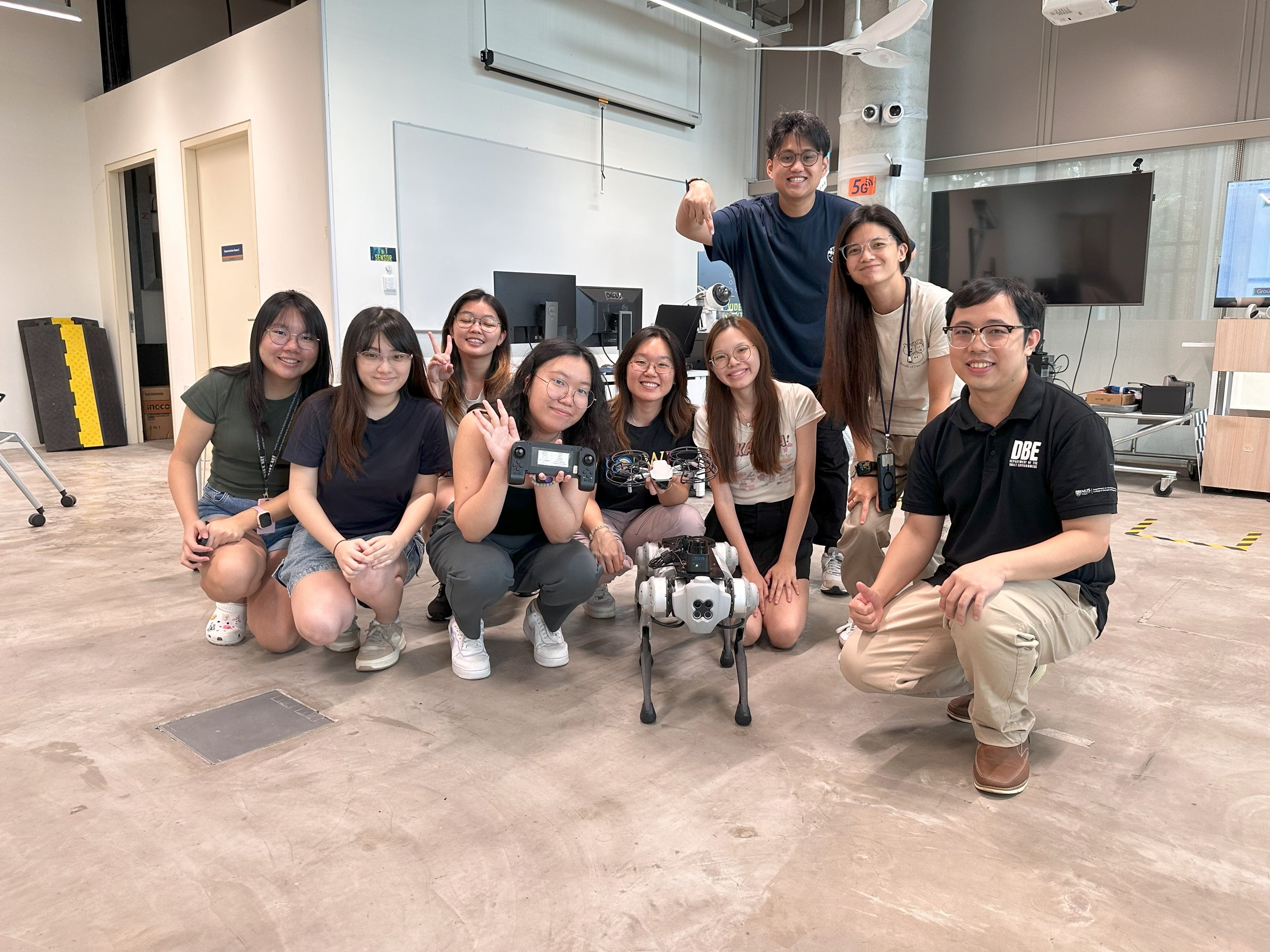
Team Members
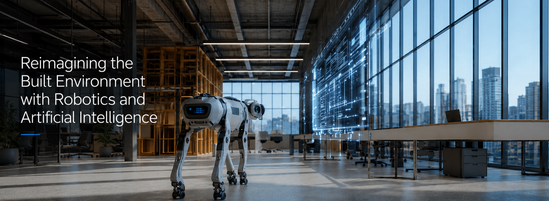
RAIS4BE Lab at National University of Singapore pioneers robotic scanning and building information modelling (BIM) technology. Since the Lab started in 2021, we focused on LiDAR, image-based sensing, and semantic AI algorithms deployed on mobile robotic platforms for autonomous 3D scanning of legacy buildings or infrastructures, followed by high-precision 3D BIM reconstruction and semantic enrichment to develop content-rich engineering models for generative design and structural optimisation. Our lab brings together researchers from Civil, Mechanical, Geodesy, Electrical and Computer Engineering.


Shuju Jing
Research Fellow
Joining
Research Fellow


Difeng Hu
PhD Researcher
Tao Wang
PhD Researcher


Qiao Zheng
PhD Researcher
Kexin Li
PhD Researcher


Josh Li
PhD Researcher
Srivatsan
PhD Researcher


Xiayi Chen
MSc (Research)
Oh Hui Lin
MSc (Research)

Yushuo Wang
MSc (Research)
Runfeng Ma
MSc (Research)


Dian Zhuang
Visiting PhD
Chao Xiang
Visiting PhD
Ben Ben
Lab Companion
Scout
Lab Companion
Mike Li
Research Fellow
Vincent Gan
Assistant Professor


Asiri
Research Associate
Shaobo Li
Research Associate


Yuanyuan Deng
Research Assistant
Jey Chandar
Research Assistant
Melanie Tan
PhD Researcher
Xiuqi Li
PhD Researcher


Bi Jian
Visiting PhD
Ruoming Zhai
Visiting PhD
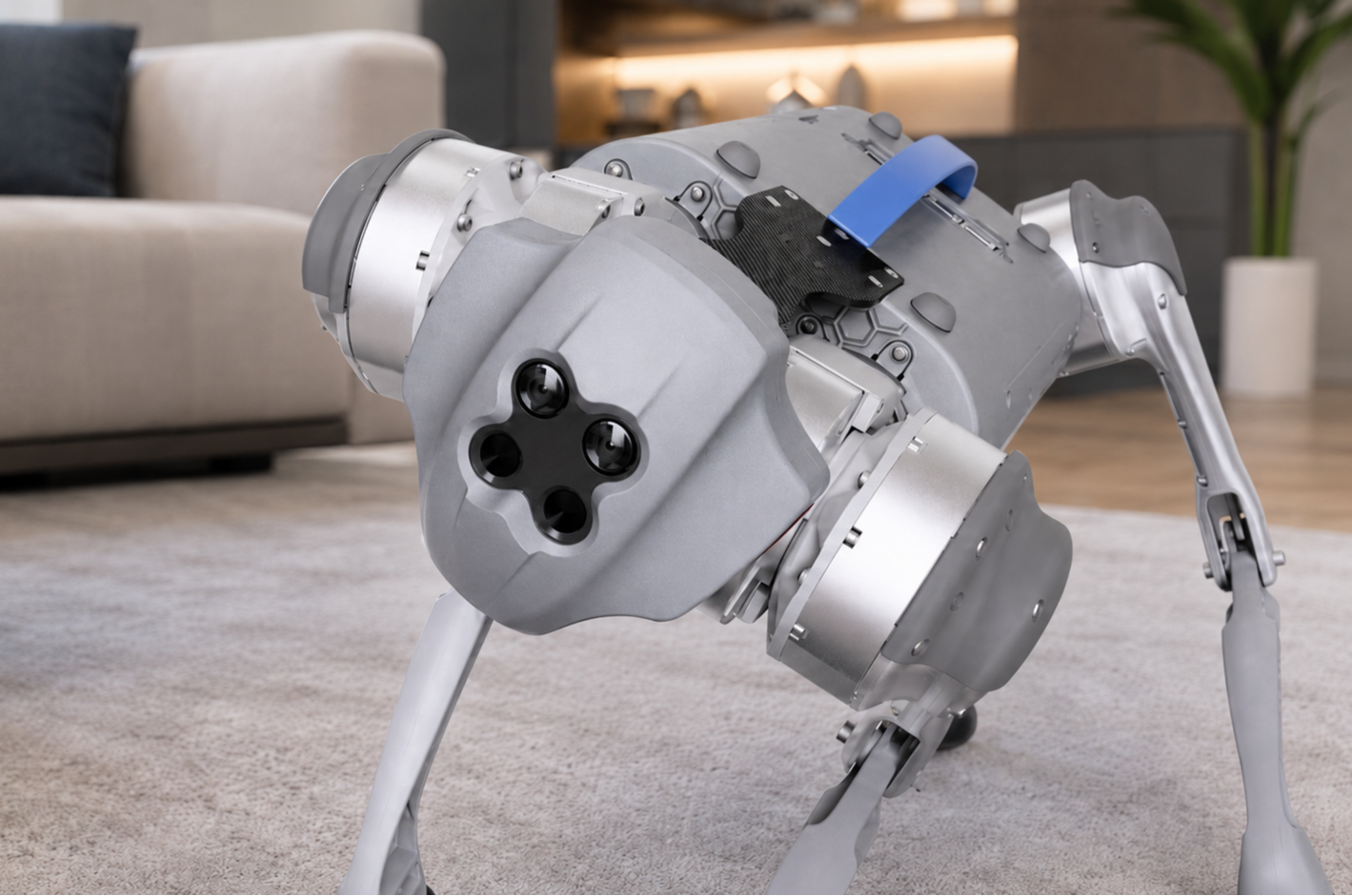
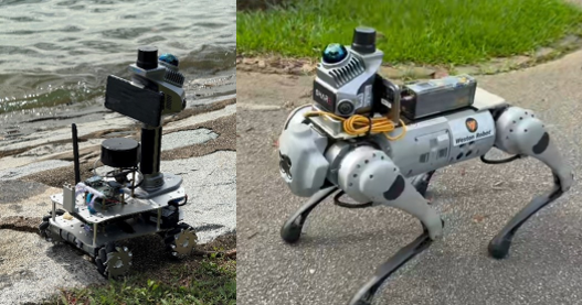
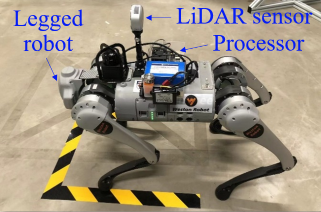
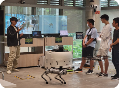
Robot Dog & LiDAR Scanning (2022)


Automated 3D Mapping & Semantic Navigation
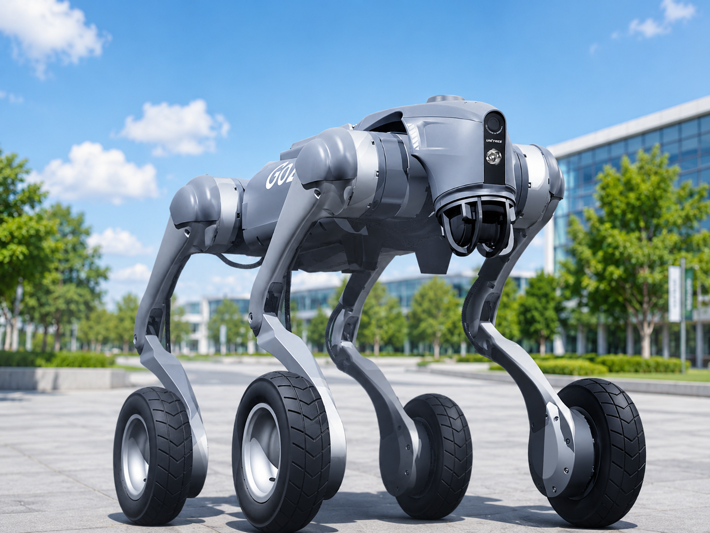
Trajectory Optimisation & 3D Perception (2024)
Our Research & Teaching


CDE Innovation Day Award

Teaching Excellent Award


Featured Publication
Deng, Y.Y., Gan, V.J.L.,* • Advanced Engineering Informatics (4.2026)
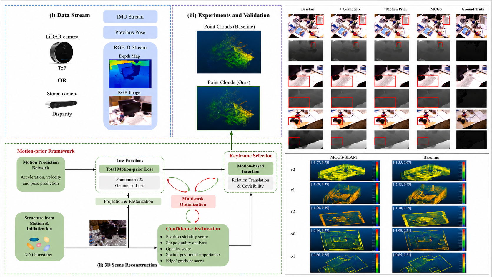
Motion-prior and Confidence-aware Gaussian Splatting (MCGS) SLAM for 3D scene reconstruction of indoor built environments
This paper proposes a motion-prior and confidence-aware Gaussian Splatting (MCGS) SLAM, which hardnesses a probabilistic motion-prior framework, confidence estimation mechanism, and adaptive keyframe selection to guide photorealistic 3D scene reconstruction.
Zheng, Q., Gan, V.J.L.,* Li, M.K., • Automation in Construction (1.2026)
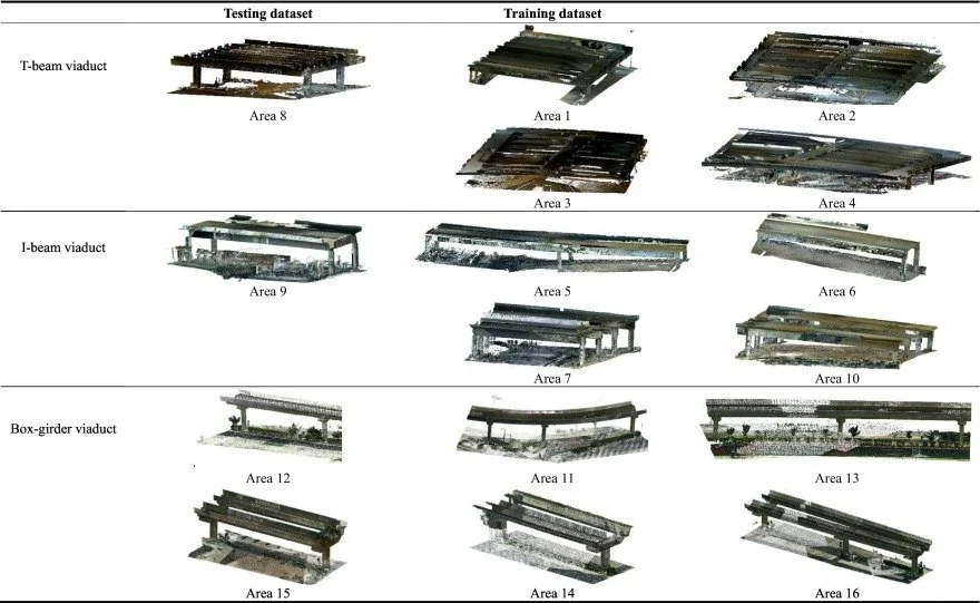
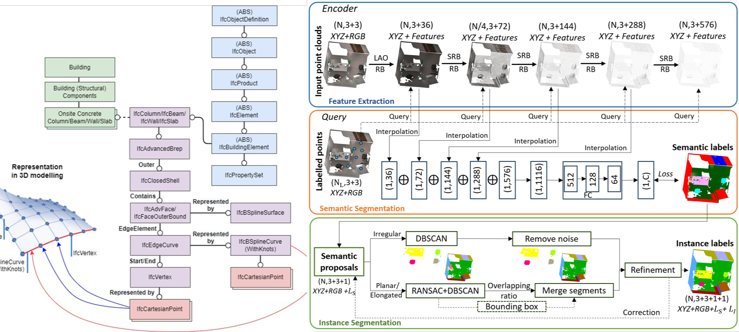
Semantic instance segmentation and automated 3D BIM reconstruction for viaduct using LiDAR point clouds and weakly-supervised learning
This paper presents an AI-based semantic instance segmentation approach that leverages weakly-supervised learning for high-precision segmentation and automated BIM reconstruction of transport infrastructure, focusing on viaducts.
Li, M.K., Gan, V.J.L.,* Wang, B.Y., • Automation in Construction (11.2025)
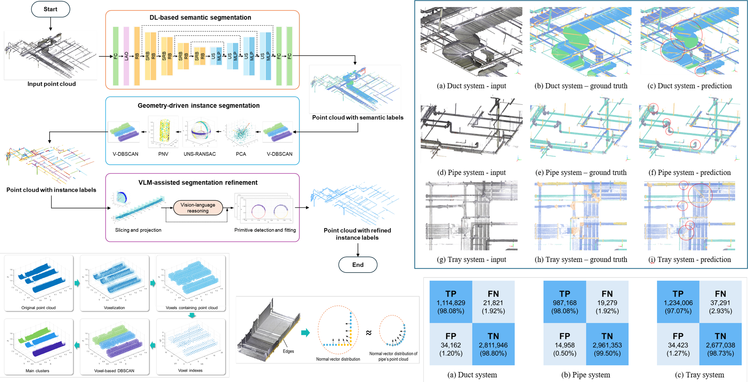
Integrating hierarchical segmentation and vision-language reasoning for spatially complex and occluded MEP point clouds
This paper proposes a hierarchical and progressive segmentation that integrates deep learning-based semantic segmentation, geometry-driven instance segmentation, and vision-language model-assisted refinement for 3D BIM reconstruction of MEP systems.
Hu, D.F., Gan, V.J.L.,* • Automation in Construction (3.2025)
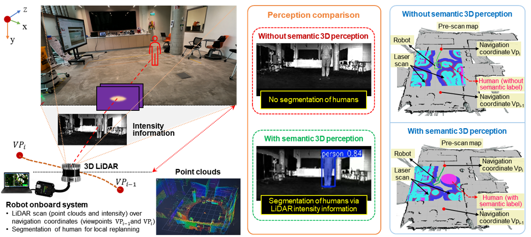
Semantic navigation for automated robotic inspection and indoor environment quality monitoring
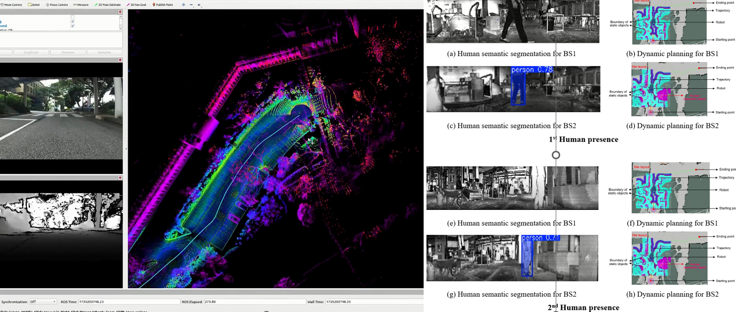
This paper proposes a semantic navigation approach to improve robotic inspection. A revised RandLA-Net and KNN algorithm construct a semantic map rich in detailed object information. An object instance reasoning algorithm identifies and extracts target object coordinates from the semantic map. A semantics-aware A* algorithm calculates safer, efficient navigation paths.

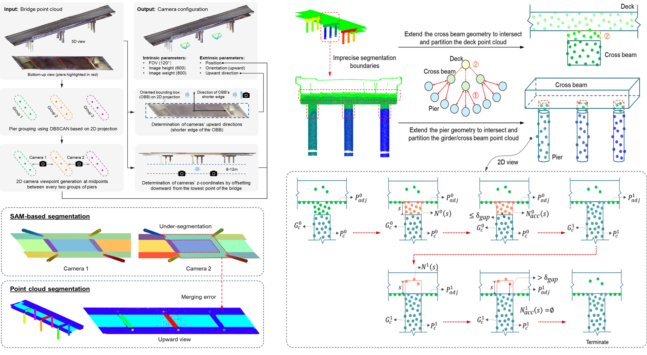
Gan, V.J.L., Hu, D.F.,* etc. • Computer-Aided Civil and Infrastructure Engineering (3.2025)
Automated indoor 3D scene reconstruction with decoupled mapping using quadruped robot and LiDAR sensor
This study introduces an optimization algorithm incorporating viewpoint generation, occlusion detection and culling, and robot-moving trajectory identification. The research investigates 3D reconstruction, comparing coupled and decoupled approaches to identify most practical configuration for robotic scanning.

Gan, V.J.L., Li, K.X.,* etc. • Applied Energy (1.2025)
3D reconstruction of BIM with weakly-supervised learning for carbon emission modelling in the built environment
This paper presents weakly-supervised learning for automated BIM reconstruction, aiming at accurate carbon performance evaluation. By employing weakly-supervised semantic segmentation, this approach segments structural components from 3D point clouds and formulates the topological relationships of objects for BIM reconstruction to assess embodied carbon.
Zhai, R., Zou, J., Gan, V.J.L.,* etc. • Automation in Construction (10.2024)
Semantic enrichment of BIM with IndoorGML for quadruped robot navigation and automated 3D scanning
In this paper, BIM data schema is enriched with IndoorGML, integrating building geometry with spatial data to establish an indoor navigation model describing multi-scale spatial topological networks. This navigation model optimizes robot scanning positions and traversal sequences.

Wang, T., Gan, V.J.L.,* • Automation in Construction (10.2024)
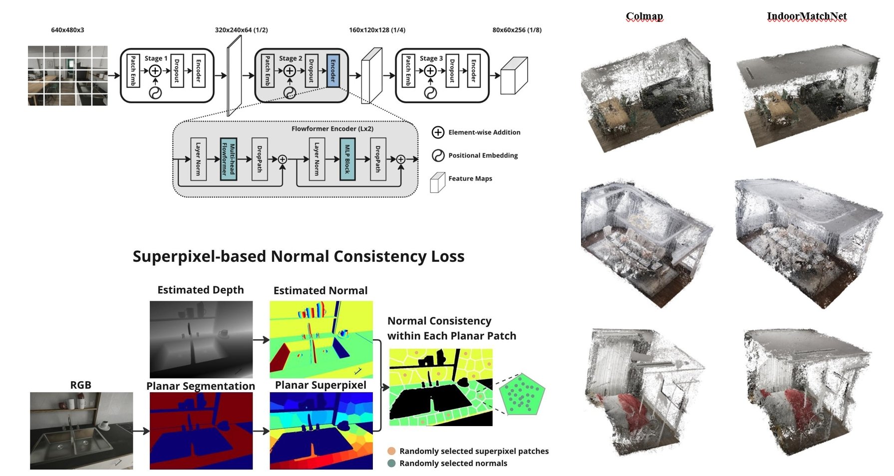
Enhancing 3D reconstruction of textureless indoor scenes with IndoReal multi-view stereo
This paper presents the “IndoReal-MVS” dataset, a rich indoor-centric compilation reflecting real-world phenomena through advanced computer graphics. It introduces unsupervised “IndoorMatchNet”, synergising Feature Pyramid Network (FPN) and Pyramid Flowformer (PFF) for encoding complex indoor geometries.
Hu, D., Gan, V.J.L.,* etc. • Building and Environment (8.2022)
Multi-agent robotic system (MARS) for UAV-UGV path planning and automatic sensory data collection in cluttered environments
This paper presents a multi-agent robotic system for automatic UAV-UGV path planning and indoor navigation to automate sensory data collection. An enhanced shunting short-term memory model is proposed to optimise the pathfinding, 2D image and 3D point cloud data collection.

Gan, V.J.L.,* • Automation in Construction (2.2022)
BIM-based graph data model for automatic generative design of modular buildings
This paper presents a Building Information Modelling (BIM)-based graph data model for the theoretic representation of spatial attributes, topological relationships, geometries, and semantics for generative design of modular buildings.


Research Innovation
Our research on robot-assisted mobile scanning focuses on integrating sensor perception model, 3D scene reconstruction and understanding algorithms, semantic mapping and navigation to support autonomous, quality-assured data acquisition in semi-structured environments. Below are the highlights from this research:
Sensor perception model and environment-aware trajectory optimisation for assuring robotic scan quality
Multi-view, GS-SLAM, domain adaption algorithm for 3D scene reconstruction and understanding in weakly-textured settings
Robot semantic navigation and autonomous LiDAR mapping in semi-structured environments
Our team members are pursuing a start-up on Scan2BIM robot to support the digitalisation and diagnosis of buildings and infrastructures
Building on robotic 3D data acquisition, our research aims to develop a geometric representation learning pipeline to transform 3D spatial data into structured, semantically-enriched BIM models aligned with building foundation model requirements. Key highlights are summarised below:
Weakly-supervised, VLM or zero-shot SAM for semantic instance segmentation of spatially complex, occluded ME systems and large infrastructural elements;
DR-GANet and knowledge based inferencing to process heterogeneous point clouds and automated BIM reconstruction
Semantic similarity matching and relationship classification for semantic enrichment of BIM data
Support digitalisation of transport infrastructure and semantic-rich 3D model for lifecycle urban evaluation
Beyond reconstruction, our computational design research focuses on graph-based representation and broad pre-training of 3D BIM geometry to capture structural priors and generate topologically valid designs capable of optimising the building performance. Below are the key components of the research:
Propose BIM-based graph data model to integrate building spatial, geometric & topological features
Create a deep learning-based surrogate model capable of predicting structural and environmental behaviours
Develop deep learning & bio-inspired generative design methods to optimise shape & structural topology of high-rise buildings
Link BIM product library for digital fabrication and construction automation